SERVICES

From the field to the report,
end-to-end service

From soil investigation to geophysical surveys, from zoning-plan studies to risky-building reports — every study is carried out under one roof, in full compliance with current regulations.

Urban Transformation Soil Investigation

We prepare the geological-geotechnical soil investigation reports required by the transformation process in areas designated for urban transformation. Field observation, drilling and geophysical surveys establish the soil profile; the site's suitability for construction is demonstrated with engineering parameters.

Reports are prepared in the scope and format required by the relevant authorities and current regulations; we carry out any revisions requested by reviewing institutions during the approval process.
FIELD GEOLOGYDRILLINGGEOPHYSICAL SURVEYINSTITUTIONAL APPROVAL
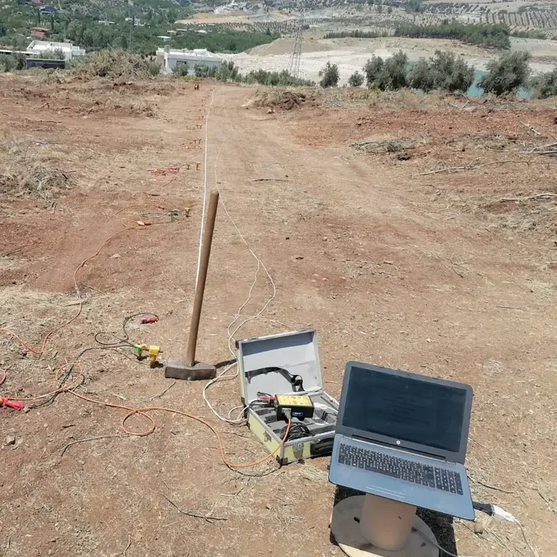
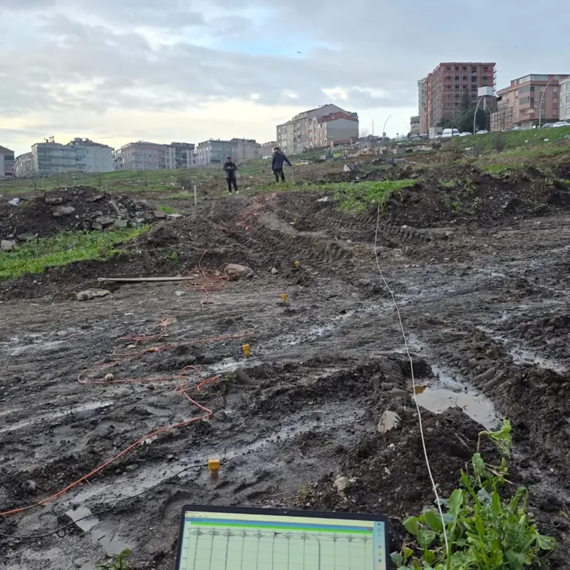
Seismic survey line laid out at an urban transformation site, with a recording computer
Seismic layout in an urban site

Site Suitability Reports & Maps

We produce site-suitability reports and their supporting maps, determining whether an area is suitable for residential, industrial or infrastructure construction. Natural hazard factors such as slope, flooding, landslide and liquefaction are assessed together.

Based on the assessment, the area is classified as suitable, conditionally suitable, or unsuitable — providing direct input to planning decisions.

HAZARD ASSESSMENTMAPPINGLIQUEFACTION ANALYSIS

Soil Investigation for Risky Buildings

For buildings undergoing the risky-structure assessment process, we prepare investigation reports that produce the soil parameters required for the assessment calculations. Drilling and geophysical surveys are carried out around the existing structure; soil class and local site conditions are reported in accordance with the current earthquake code.

RISKY-STRUCTURE ASSESSMENTSOIL CLASSEARTHQUAKE CODE
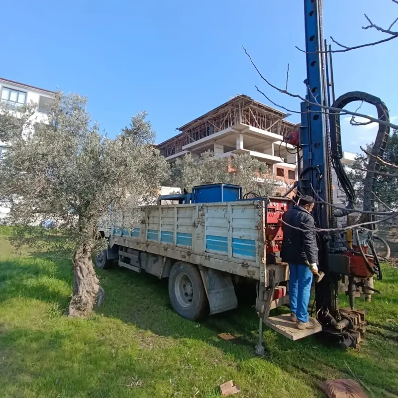
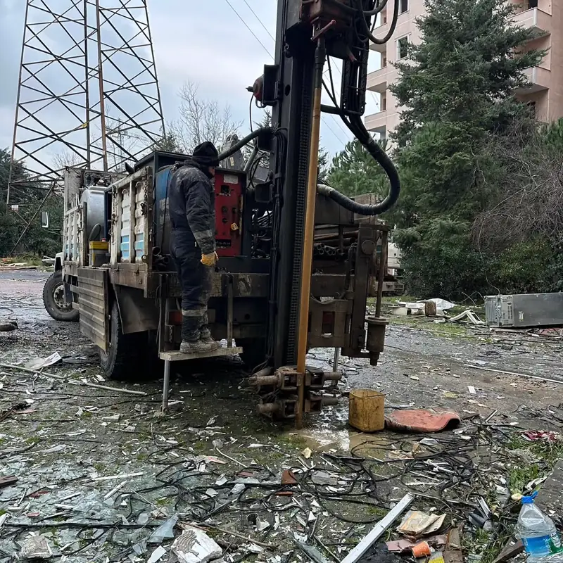
Truck-mounted drilling rig and operator working around an existing building
Drilling around an existing structure

Parcel / Block-Based Soil Investigations

We prepare soil investigation reports at parcel and block scale to support building-permit applications. Bearing capacity, settlement and foundation design parameters are determined through drilling, field tests and laboratory testing.

The report is prepared to feed directly into the structural design; coordination with the project's structural engineer continues throughout the process.

BUILDING PERMITBEARING CAPACITYFOUNDATION DESIGN
Truck-mounted drilling rig working within a parcel next to a residential construction site
Drilling at parcel scale

Zoning-Plan Geological-Geotechnical Studies

For areas where a zoning plan will be prepared or revised, we prepare the geological-geotechnical study reports that form the basis for planning. Regional geology, natural hazards and soil conditions are assessed together, producing synthesis maps that underpin planning decisions.

ZONING PLANGEOLOGICAL MAPPINGNATURAL HAZARD ANALYSIS

Soil Drilling

We carry out drilling — the backbone of any soil investigation — under every kind of terrain condition. Field tests such as core drilling, SPT (Standard Penetration Test) and pressuremeter are recorded together with disturbed/undisturbed sampling, borehole logs and groundwater observations.

From tight sites within residential areas to valley floors, from snow-covered job sites to work requiring a floating offshore platform — the drilling program is planned around the site's conditions and completed without interruption.

CORE DRILLINGSPTPRESSUREMETERSAMPLINGBOREHOLE LOG
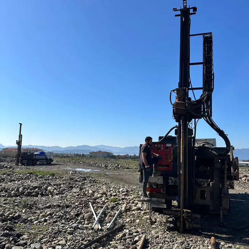
Operator working at a drilling rig in open terrain
Drilling crew in the field — Muğla

Geophysical Surveys

We apply geophysical surveys — non-destructive methods for imaging the subsurface — in full integration with drilling data. Seismic, electromagnetic and mechanical methods are used to determine the soil's dynamic parameters, layer geometry and any potential voids.

SEISMICRESISTIVITYMICROTREMORGPR
Seismic survey with a survey line laid out in the field, a sledgehammer, and a recording computer
Seismic survey — Hatay

Microzonation Reports

We prepare microzonation reports that form the basis for zoning planning and disaster-risk management. Soil behavior at the regional scale is mapped using drilling, geophysical survey and laboratory data, producing a scientific basis for settlement decisions.

Where the scope requires it, paleoseismology studies are also included in the field program; data is collected and reported for active-fault investigations.

MICROZONATIONPALEOSEISMOLOGYDISASTER-RISK MANAGEMENT
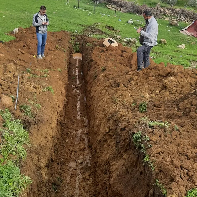
Geologists examining a trench opened for active-fault investigation
Paleoseismology trench — Nurdağı

FIELD CAPABILITY

We're on-site, in every condition

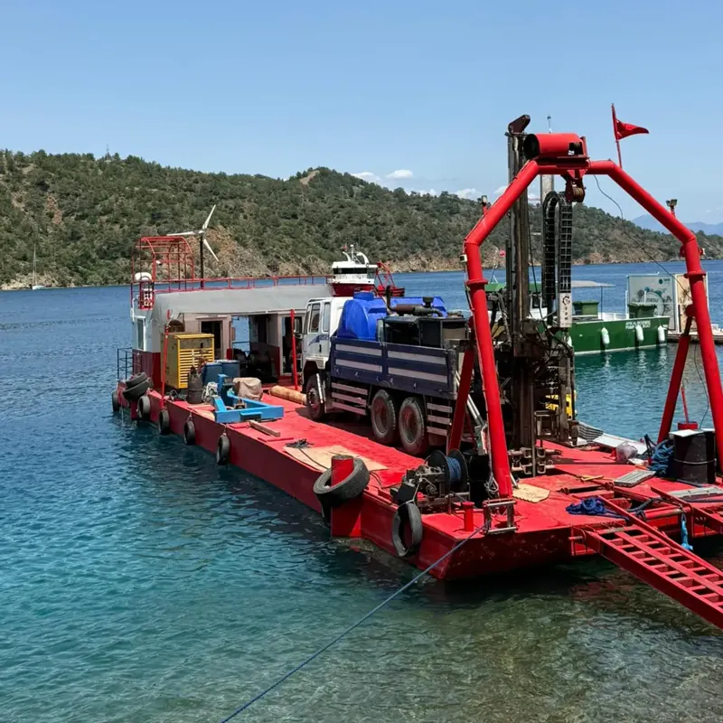
Truck-mounted drilling rig performing offshore drilling from a floating platform anchored in a bay
Offshore drilling with a floating platform
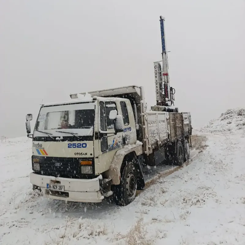
Truck-mounted drilling rig fieldwork in falling snow
Drilling in winter conditions
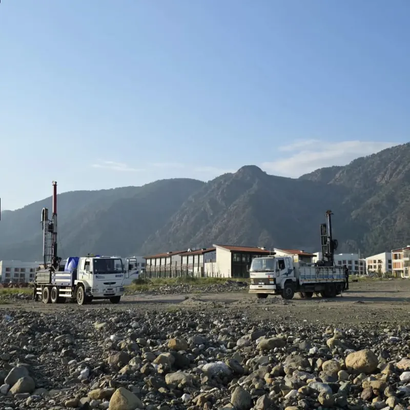
Two truck-mounted drilling rigs working simultaneously on a large site in front of mountains
Multi-rig field program — Muğla

GEOPHYSICAL WORK

Reading the subsurface with multiple methods

Seismic Refraction, Reflection, ReMi & MASW

P- and S-wave velocities determine layer geometry and dynamic soil parameters.

Single-Station Microtremor Measurements

Velocimeter recordings measure the site's vibration behavior at a single point.

Resistivity (VES), Dipole & SP Measurements

Electrical resistivity methods map stratification, groundwater and discontinuities.

Void Detection with Ground-Penetrating Radar (GPR)

Ground radar detects subsurface voids, fill material and buried structures.

Earthquake Acceleration Measurements

Site-specific acceleration records provide data for earthquake-load assessments.

Site Amplification & Mapping

The amplification effect of local site conditions on seismic waves is calculated and mapped.

Earthquake Risk Analyses

Site and regional data are combined to report earthquake hazard in engineering terms.

Predominant Vibration Period Determination

The site's predominant vibration period is measured; structure-soil resonance risk is assessed.

FREQUENTLY ASKED QUESTIONS

Common questions

A soil investigation is the technical study carried out to determine the geological, geotechnical and soil properties of the land where a structure will be built. Drilling, laboratory testing and geophysical surveys are used to determine the soil's bearing capacity, settlement potential and groundwater level.

A soil investigation is both a technical necessity for building safety and a legal requirement in zoning and building-permit processes. It is a core input for safe design against earthquake risk and for choosing the correct foundation system.

This varies with project scale and soil conditions, but a soil investigation is usually completed within 1–2 weeks. The field program is confirmed precisely after the site visit.

We serve construction, infrastructure and environmental projects. Our field teams work in every region of Turkey; our head office is in Kağıthane, Istanbul.

You can call +90 535 929 76 09, send an email, or fill out the contact form. We'll get back to you as soon as possible with your project details.

QUOTE & SITE VISIT

Let's plan your project's soil program together

+90 535 929 76 09